Translate

Showing posts with label GPS. Show all posts

Friday, December 19, 2014

MapTrack: 30 000 miles or 11 months of live tracking.


In August we wrote about MapTrack being used during a trip around the US. Recently Brian finished his journey and contacted us with his feedback and some statistics:

"Our epic road trip has finally come to an end. We start making our way home tomorrow so I've just turned off MapTrack after 11 months. I just wanted to let you know the app has performed great! 30,000 miles on the odometer of our RV... "

We would like to thank Brian for choosing our app for such interesting trip and we are glad the app was helpful over this long period of time.

MapTrack is Android app for recording and sharing tracks in real time. Google Drive is used to save and share data. You need to use your  Google account and you can manage track files from Google Drive. The app does not require registration on third-party services and your followers can view your track in usual web browsers on Google Maps. 

MapTrack Android app on Google Play

Monday, August 25, 2014

Our Android MapTrack app has been used during a trip around the US for six months now.


MapTrack is an Android app for recording and sharing tracks in real time. One of MapTrack users (Brian) has been using it during his trip around the US for last 6 months.

He has embedded Track Viewer from the app into his blog

If you are interested in tracking and measurements on maps please check also our Planimeter app.

MapTrack Android app on Google Play

Wednesday, July 30, 2014

SolarMeter - GPS solar measure. Solar energy or solar panel output estimation at your current location.


SolarMeter - GPS Solar Measure is Android solar energy analyzer tool that allows you to calculate and estimate solar power and energy output of a solar cell panel at specific location. 

SolarMeter helps you to check solar potential of your roof, how much solar power you are getting at your location throughout the year and to estimate how much energy a photo-voltaic system can generate per month. 

SolarMeter Features: 

  • Real-time solar power calculation based on current location, panel/device orientation and panel/device tilt 
  • Solar Power and Energy calculation for different period of time: day, month, year 
  • Ideal (calculated) and experimental statistical solar data (offline) available 
  • Sensor based inputs for orientation and tilt 
  • Automatic current location search using GPS and Network 
  • Graph/Plot 2D data presentation 
  • Solar panel efficiency control 
  • Bill and Saving estimation based on user input (energy monthly or annual consumption). 
  • Roof tilt angle measurement 
  • Roof area calculation based on Planimeter* or/and Partometer* apps measurements 
  • Metric and Imperial units 

Go Green! 

* Note: These apps need to be installed to be able to use them for measurements.


Planimeter Android app on Google Play

Tuesday, July 29, 2014

How to use “Planimeter - GPS Area Measure” on iOS and Android in Manual Tracking Mode.

GPS Tracking Mode: time and accuracy settings.

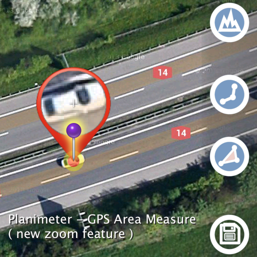
Tracking Mode is one of the distinctive features of Planimeter - GPS Area Measure app. It can be used to measure track or path distances and to measure areas of objects or territories by  driving/biking/walking around. You have an option to set GPS accuracy (if GPS is available on your device) and time interval for dropping a pin. If both conditions are satisfied, your current location is added to to the track automatically. Please note, mobile GPS provides accuracy ~2-3m in the best conditions, so make sure it is enough to satisfy your particular requirements.

Sometimes you want to measure an area or distance using tracking feature but you need to place waypoints manually only at certain locations and avoid redundant points in between. You can do it by selecting MANUAL option for the tracking time interval

[LONG TOUCH on Track button ]

to see  time interval options for Tracking Mode.  “Set Point”  button will appear at the bottom of the screen. Now when you start tracking,  your current location - green pin - will be constantly updated as long as GPS accuracy condition is satisfied.  When you are ready to add a point to your measurement track -  just touch “Set Point”  button.

Tracking Mode with Manual option is a very handy feature and can be applied for different tasks. For example, it can be used for mapping objects or places for later use or visit.
Another application where manual tracking can be useful is marking your property with poles. First you can manually (by touch) build a pole line on maps  in Planimeter with required distances between pins. Then you can use Tracking with Manual option enabled to visually estimate your current location (green pin) relative to the planned path and red pins (poles) on it. As soon as you are close enough to the planned point you can place a pole and move to the next point.

Planimeter Manual for iOS

Described functionality available on both iOS and Android versions of the app.
Planimeter Android app on Google Play

Thursday, July 24, 2014

"Planimeter - GPS Area Measure" - popular Android app for measurements on maps is now available for iOS.

"Planimeter - GPS Area Measure" on iOS


We have had many requests from users about developing iOS version of our popular map measurement app - “Planimeter - GPS area measure”. The app has been available on Android platform for some time  and received very positive feedback.

We are proud to announce that the first version of "Planimeter - GPS area measure" has been released and available on the App Store.

This version of the app is not exact copy of the Android tool in terms of functionality. Android version of Planimeter has evolved over time (with kind help, feedback  and suggestions from the app users) from a simple tool for manual distance estimation on Google Maps to the tool with many handy features used by professionals on a daily basis.  The first iOS version of the app uses Apple Maps and already offers plenty of features for comfortable and productive work:

  • Accurate distance and area calculation
  • Metric and Imperial units (m, km, feet, yards, miles, ha, acres)
  • Angle between lines
  • Bearings To and From selected point
  • Forth and Back navigation through points by touch on Info Panel
  • GPS coordinates of a point
  • GPS accuracy settings (if GPS available)
  • Manage previously saved projects: open, save, share KML files
  • KML files created by Planimeter can be imported to  Google Earth and Google Maps to view on a desktop
  • Send data by email: picture, coordinates as text message, KML file
  • Save KML or TXT in local storage
  • Map/Satellite View
  • Zoom and Edit points
  • Current location search
  • Text (address) search
  • Delete selected/last/all points
  • Zoom to Fit-in and center points on a screen - quick points search
  • Add points by touch
  • Add current location as a point
  • Show location with Latitude and Longitude coordinates
  • Add points by Geo-coordinates: Lat and Lng
  • Option to center last point added
  • Option to show/hide lines
  • Preferences: location accuracy, tracking time interval, delete points confirmation, sound option for tracking
  • Separate units settings for distance, area, perimeter
  • Target Mode for accurate pin placement
  • Show current coordinates in Target Mode
  • Stylus Draw Mode
  • Full-screen option
  • GPS TRACKING
  • Manual pin placement option in GPS Tracking


You can read our recent post, Measurements on Google Maps using Planimeter App, about Android version that gives a good overview of the app, its applications and user experience with the app. We hope the app  will also be useful for iOS users.

Here is an example how you can quickly estimate area on the map in manual mode:


We would appreciate any feedback, early bug reports and improvement suggestions from you. Please contact us at support@vistechprojects.com.


Saturday, July 19, 2014

"Planimeter - GPS Area Measure" with new Magnifying Glass / Zoom feature - even more accurate measurements on Google Maps.

Update v3.8.0 for “Planimeter - GPS Area Measure” on Android features Magnifying Glass option in Edit Mode.

This feature comes in handy when you need to adjust pins accurately on the map  while working in Edit Mode. It solves the problem with fingers blocking a view while editing your measurements  and also brings some extra zoom for more accurate pin placement.

Magnifying Glass option is available in Preferences and  enabled by default in the latest version of the app.


See a short video how the new zoom feature helps to place pins on Google Maps accurately:


Planimeter Android app on Google Play